
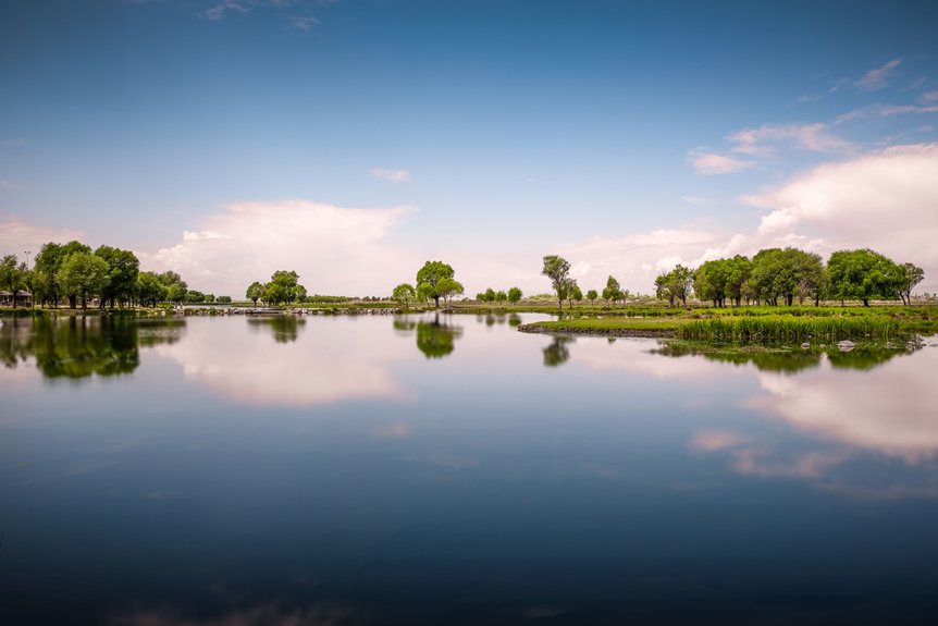
Georgia lake restoration focuses on cutting sediment and nutrient loads that drive algal blooms and hypoxia. Projects use shoreline armoring and bioengineered banks to reduce erosion by 60–90%, and wetland/buffer systems that remove 40–80% of phosphorus and over 60% of nitrates. Urban retrofits, green infrastructure, and agricultural BMPs commonly achieve 50–80% reductions in suspended solids. Ongoing monitoring of turbidity, chlorophyll‑a, and Secchi depth confirms improvements and points to additional strategies that can be adopted.
Although many of Georgia’s reservoirs still appear scenic at a glance, water quality data and long-term monitoring records indicate that numerous lakes across the state are experiencing accelerating degradation that warrants immediate restoration action.
Georgia’s scenic reservoirs mask accelerating, data‑confirmed decline, demanding urgent, science‑driven restoration action now
Trend analyses from GA EPD and USGS stations show rising nutrient concentrations, declining Secchi depth, and increasing chlorophyll‑a, signaling more frequent and intense algal blooms.
Dissolved oxygen profiles reveal hypoxic bottom waters during critical summer periods, compressing habitat for cold-water and sensitive species.
These trajectories threaten drinking water reliability, hydropower efficiency, and recreation-based economies.
Without near-term intervention, restoration costs will escalate as systems cross ecological thresholds.
Data-driven, adaptive restoration programs—linked to continuous monitoring, predictive modeling, and performance-based funding—are now essential to reverse trajectories and protect long-term lake resilience. Comprehensive lake monitoring that tracks oxygen levels, algae, and sediment conditions is critical to guide targeted, cost‑effective restoration actions.
When storm events mobilize eroded soils, fertilizers, and urban pollutants from Georgia’s watersheds, the resulting sediment and runoff loads fundamentally alter lake physical and chemical conditions. Fine sediments increase turbidity, cutting light penetration and suppressing submerged vegetation that stabilizes shorelines and uptakes nutrients.
Attached phosphorus and nitrogen from agricultural and suburban sources intensify eutrophication, driving algal blooms and episodic hypoxia.
Runoff also transports metals, hydrocarbons, and microplastics from roadways and developed areas, accumulating in benthic zones where they can disrupt invertebrate communities and bioaccumulate in fish. Channelized inflows accelerate deposition in coves and embayments, infilling critical littoral habitat and shortening reservoir life.
These linked impacts underscore the need for precision watershed diagnostics, predictive modeling, and targeted, performance-monitored interventions.
Because sediment- and runoff-driven impairments manifest through multiple, interacting pathways, Georgia lake restoration projects are structured around a concise set of measurable goals: reducing external nutrient and sediment loads at the watershed scale, stabilizing in-lake water quality (e.g., maintaining chlorophyll-a, Secchi depth, and dissolved oxygen within target thresholds), and recovering critical habitat structure in littoral and nearshore zones.
Load-reduction targets are increasingly expressed as percent decreases in annual TN, TP, and TSS flux, derived from watershed models and long-term USGS or local monitoring datasets.
Water-quality goals emphasize attainment of state criteria at high-frequency timescales, using sensor arrays and profiling sondes.
Habitat objectives prioritize reestablishing native macrophyte coverage, coarse woody habitat density, and substrate heterogeneity, supported by quantitative pre- and post-restoration assessments.
Shoreline stabilization in Georgia lakes focuses on reducing erosion-driven sediment inputs while preserving nearshore ecological function through a mix of engineered and bioengineering approaches. Strategies are selected using site-specific metrics such as bank height, wave energy, soil shear strength, and observed annual retreat rates.
Shoreline stabilization in Georgia lakes balances erosion control with healthy nearshore habitats using site-tailored engineered and bioengineered solutions
Although in-lake treatments can address symptoms of eutrophication, durable water-quality gains in Georgia lakes depend on restoring fringing wetlands and vegetated buffer zones that intercept pollutants before they enter the water column. Empirical studies show intact lake-margin wetlands can remove 40–80% of incoming total phosphorus and over 60% of nitrates through sedimentation, sorption, and denitrification.
In Georgia’s Piedmont and Coastal Plain, restoration designs increasingly specify 30–100 foot native vegetated buffers, layered with deep-rooted grasses, shrubs, and trees to maximize roughness and infiltration. Grade-controlled microtopography and shallow cells enhance residence time and contact with organic-rich soils.
Performance monitoring—using inflow/outflow nutrient ratios, turbidity, and sediment accretion rates—guides adaptive management and prioritizes reaches delivering the greatest load reductions per restoration dollar.
How can rapidly urbanizing Georgia communities curb lake pollution when every new rooftop, road, and parking lot accelerates runoff and nutrient delivery? Forward-leaning municipalities are shifting from conventional curb‑and‑gutter to distributed stormwater controls that detain, infiltrate, and treat flows before they reach lakes, targeting peak-flow reduction, nutrient removal, and thermal mitigation.
Key strategies include:
While advanced stormwater systems can intercept a portion of urban runoff, a large share of sediment and nutrient loading to Georgia lakes still originates from exposed soil on fields, construction sites, and residential yards. Empirical monitoring often attributes 60–80% of suspended sediment in tributaries to these disturbed surfaces.
On farms, high‑residue cover crops, controlled traffic, and 35–50 foot vegetated riparian buffers can reduce soil loss by more than 70%. Construction sites benefit from phased grading, polymer‑enhanced sediment basins, and erosion control blankets targeting less than 1 ton/acre/year loss.
In residential areas, rain gardens, permeable pavements, and no‑till landscaping stabilize micro‑sheds. Remote sensing, LiDAR-based erosion modeling, and IoT turbidity sensors enable adaptive management and performance verification across all landscapes.
Across Georgia, multiple lakes now demonstrate quantifiable water quality and habitat gains resulting from coordinated watershed restoration. These projects integrate sediment-source control, in-lake treatment, and performance monitoring to validate outcomes.
1. Lake Allatoona – Targeted streambank stabilization and construction-site BMP enforcement reduced suspended sediment by an estimated 30–40%.
The Secchi depth improved from approximately 0.4 m to 0.7 m in treated coves.
2. Lake Lanier – Retrofit of aging stormwater systems and bioretention cells cut localized total phosphorus loads by up to 25%.
This reduction has helped curb algal bloom frequency.
3. Lake Blackshear – Wetland cells and dredging in delta zones increased storage, reduced siltation, and restored littoral habitat complexity.
4. Lake Oconee – Shoreline bioengineering and controlled drawdowns decreased bank erosion rates.
These efforts have improved spawning substrate availability and macroinvertebrate diversity.
An effective lake restoration program in Georgia depends not only on agency-led projects, but also on coordinated resident and community actions that measurably reduce pollutant loads at the parcel, neighborhood, and watershed scales. Residents can retrofit properties with rain gardens, permeable pavements, and 50–100 foot native vegetated buffers, reducing sediment and nutrient export by up to 60–80%.
HOAs and civic groups can form lake stewardship districts to coordinate shoreline stabilization, septic system inspection schedules, and fertilizer-free zones, tracking outcomes through turbidity and chlorophyll-a monitoring.
Citizen science networks, equipped with low-cost sensors and mobile apps, can supply high-frequency data to validate models and target BMPs. Local stormwater utilities can offer fee credits and microgrants for documented load-reduction projects.
Typical Georgia lake restoration projects range from roughly $500,000 to $5 million, funded through blended mechanisms: state and federal grants (e.g., Section 319), county/municipal stormwater utilities, special tax districts, mitigation banks, and private stakeholder cost‑sharing.
Lake restoration in Georgia is governed by USACE Section 404, Georgia EPD NPDES/401, Georgia Erosion & Sedimentation Act, buffer protection rules, and local ordinances—where the rubber meets the road is rigorous modeling, monitoring, and adaptive compliance.
Water quality improvements typically emerge within 6–18 months, depending on nutrient loads, hydrology, and restoration intensity. Early gains appear in turbidity and suspended solids; more substantial shifts in chlorophyll‑a, dissolved oxygen, and biotic indices require multi‑year, adaptive management cycles.
Access may be temporarily restricted in specific zones, with phased closures, buoyed work areas, and time‑of‑day limits; yet, like a thousand suns of innovation, staging, signage, and adaptive scheduling minimize disruption while preserving boating, fishing, and swimming safety.
Private shoreline owners may access state 319(h) nonpoint source grants, federal NRCS EQIP funding, and local cost‑share rebates for green infrastructure, bioengineered banks, and permeable surfaces, typically covering 40–75% of eligible design, construction, and monitoring expenses.
Georgia’s lake restoration efforts demonstrate that targeted sediment control, shoreline stabilization, and stormwater upgrades can measurably improve water clarity, habitat quality, and recreational value. As monitoring data confirm declining nutrient and turbidity levels, these systems respond like a recovering patient gaining strength with each treatment. Continued investment in best management practices, enforcement of erosion controls, and community participation will be critical to scaling these successes and securing resilient, high-quality lake ecosystems across the state. For more information on how Clean Flo can improve the health of your lake or pond, visit us online at Clean Flo. You can also check out our video series on our YouTube channel.